本文へスキップ
Wada, Nagawamachi Town, Nagano Pref.
 
 
From Medieva Castle-Town to Stage-Town

  As in Jomon period, about 5000 years ago, the obsidian became an important trade materials, the area around Wadatoge must have gotten a key position in politics, economy and culture since ancient age. Tosando, the official road from Kyoto or Nara to the east Shinano through Oomi, Mino and Kiso, was founded at latest in Nara period, the early stage of 8th century.
  Tha fact that some official pastures bringing up military horses for Yamato Monarchy was founded in the east Shinano had a concern with its campaigns conquesting the east Japan.
  They had to get over Wadatoge between Utsukugahara and Kirigamine highlands to go from Kiso to Saku. Therefore the villages from Wada to Nagakubo or Yodakubo area must have developed as traffic key points since then.


▲A hill creeping behind Shinteiji temple is Shiroyama. Wada Castle of the Oois was on its northeast end.


▲画像の左端から中央に張り出した尾根が城山

  I suppose that the medieval landlord regime grew here earlier. In 14th century a branch clan of the Oois built a fortress on the hill called Shiroyama on the northwest side of the Wada. It's Wada Castle. The lord's residence was at the precincts of Shinteiji temple or the place next to it.
  In the area just under the fortress they cultiveted actively farm fields and their village as a castle-town was prospering.
  But the Oois was destroied by the Takedas in 16th century. At the begininng of 17th century Nakasendo was built under the order of Tokugawa Shogunate government when a new village was constructed in the area from Nakamachi to Shimomachi where had been outskirt of the town. It was the stage-town Wada. ⇒Article concerned

■From Kajiashi to Kosatsuba

◆Rich Farm Village◆

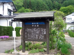
  Let's walk from Kajiashi to Kosatsuba, i.e. the site of the official bulletin bord.
  We can not find the trace of Masugata on Kaido road now. Is it because they had been formed long before the stage-towns of Nakasendo was built ? However there is an old path approacing to Ganoji temple and Shaguji shrine. I suppose it was the oldest way of the road, because now it turns in a right angle before it gets together tothe road.

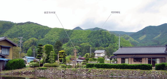
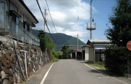
  Walking about Kajiashi, we find out that it was growing in a deep relation with the traffic and the commercial circulation of Wada town along Nakasendo. It has been a rather rich farm village.


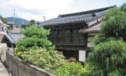
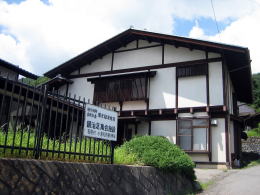
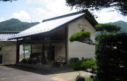
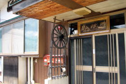
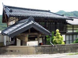
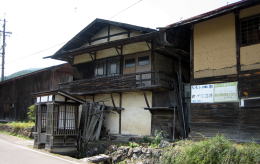
▲A house of Dashibari architecture


▲View in another angle


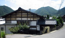
▲The house has a small Yakuimon gate. It had been greater than it is before the road was widened, I guess.

◆View Calling back Old Days◆

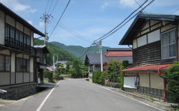
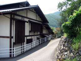
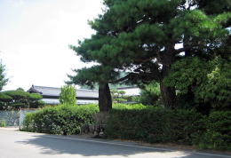
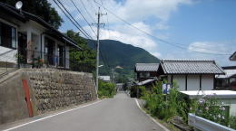
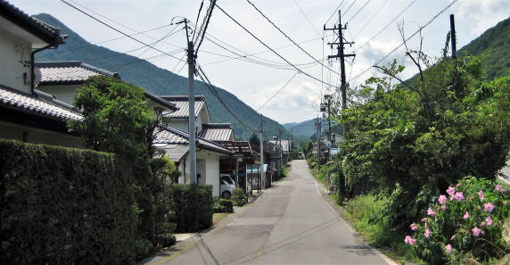
  Some houses of the traditional architecture are standing along the road. Though its rooves have been changed from thatched one into tiled one, they has kept enough features to call back the old days.

  The allocation their sites has kept the town-shapes ― the arangemant of houses along the road ― of those days. The condition that the town has been next to the stage-town and along Kaido road has influenced deeply the formation of a village.
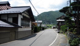
  As the road has been widened often, theier gardens facing it has gotten smaller.

◆Regret about the Fading◆

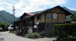
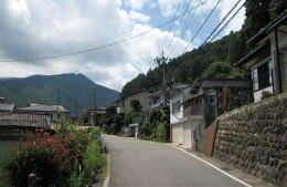
  We would find some houses ruining along the road. They may have been out of life. If they had fallen down throughly it would be too expensive to rebuild them. I only hope to keep them as cultural assets telling us the history of Kaido.【see two pictures below】


▲Houses devastated


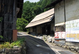
▲Out of life, but I hope them to be kept

◆旧街道めぐりの楽しみ◆

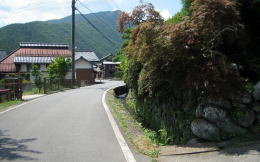
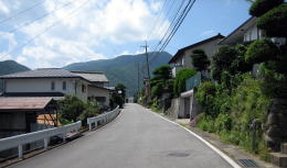
  私は、背後に山尾根を背負っているため、緩やかに屈曲したり上下したりしてるこの道形がことのほか気に入っています。尾根丘陵が道と集落に割り込んできたり、逆に谷のような窪みと沢が横切ったりしてているこの姿が。
  力任せに直線化したり、高みを削り凹みを埋め潰す今風の道は、便利で安全ですが、面白味に欠けます。しかも、運転者に速度を落とす謙虚さを失わせます。自然や歴史に対して一歩も二歩も譲る、そういう姿勢で旅をしたいものです。


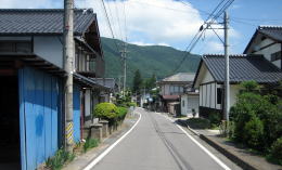
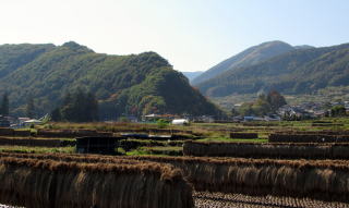
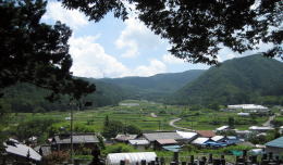
▲View toward Kanmachi from Kosatsuba


View of Kajiashi from crossroad


Looking back the way I walked


Look down Kajiashi village from Ganoji temple

Community center of the village


Path behind it

Clean water flows on roadside


Old mud-walled warehouse


Garden and site impressing richiness

Stylish decoration of entrance with frame and wheel of cart


Old houses out of life : I like them much.

A way curving slightly on Mountain-foot

Hill rushing behind houses


View of Ooideyama's peak

What waits me over the scene ?


Information bord at Kosatuba site


Townscape of Kajiashi mixed with farm village view

 
Information

Walking Map around Wada

  • Geography around WadaTown
  • Central Area of Wada

Historic Map of Wada

  • Change since Age of Medieaval Castle-town
  • Tracing the town's developmant

Map for Wadatoge Trekking

  • Map for Pass-Walking
  • Information about Historic Sites

Walking around Wada

  • Around Wadajuku Station
  • Neighborhood

Situation near Oikawa in Edo period

  • Vertical Section of Kaido
  • It was so difficult to travel

History of Nakasendo

  • Institution of Kaido and Stge-Towns
  • Shogunate Regime and Kaido System

Architecture of Town -Houses

  • Town-Houses along Nakasendo
  • Learn to enjoy town- walking

中山道の絵地図

  • 京と江戸を結ぶ中山道の絵地図です。
  • 東海道や日光街道、甲州街道、北国街道との連絡を図解。

信州の街道連絡絵図

  • 信州には多くの街道が通っていた。
  • 新旧の中仙道の経路を比較できます。

中山道宿駅一覧絵地図

  • 中山道のすべての宿駅を図示。
  • 中山道の旅を楽しもう。

馬籠峠を歩く

  • 馬籠宿から妻籠宿まで馬籠峠を越える道を歩きます。
  • あなたも歩いてみませんか。

中山道の町家造りの説明

  • 奈良井宿の町家造りの仕組みの解説です。
  • 街並み探索がもっと楽しくなります。

木曾路の絵地図

  • 木曾路のすべての宿駅を表示した絵地図です。
  • 木曾路一帯の名所や観光施設の案内に役立ちます。
のんびり写真館

街歩き写真館

木曾路・奈良井の心に残る風景写真を特集

  • 街並み景観、風物
          フォトギャラリー
  • 木曾路・奈良井散策

奈良井まちあるき

小布施まちあるき

別所温泉まちあるき

塩田平をめぐる旅

◆ブログ風の記事案内を見る

|  previous  |  next page  |