本文へスキップ
Wada, Nagawamachi Town, Nagano Pref.
 
 
Core Zone of Stage-Town


▲View of Shimomachi from foot of Oikawabashi bridge ; House on right hand is Kawachiya.

  The core zone of Wada town is Shimomachi, I think. At the beginning of 17th century the stage-town of Wada was built for a makeshift quickly in the place which would be called lately Shimomachi and Nakamachi.
  Shimomachi area had been a castle-town dominated by the Wada-Oois as a landlord. And some other vassals of the lord and poweful families lived in the area, lately called Nakamachi, next to it. They held farm fields around there.


▲A road surface was even as the top of the stone-wall.
  The road-goround was digged down.

  On the picture above Oikawabashi bridge is on front side. The bridge was set on the lower ground of river-bank ― at the bottom of the ravine ― in Edo period. As the picture on the left side shows, the surface of the road was higher by 1.5 meter than it is now in front of Yamakiya. After Meiji period the ground of the road was digged down to make it flat. The height-gap was covered with stone-walls.
  In Showa period almost part of the ravine was reclaimed by laying earth on it and the new bridge was built on the banks sustained with stone-walls.
  The travellers coming from Nagakubo had to get down over three meters for walking over the bridge and to go up on a slope to arrive at the center of town. ⇒Picture of vertical section of Kaido around the river

■Around Shimomachi■

◆Landform Change of Kaido


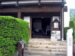
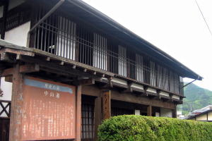
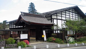
▲Entrance of Historic Road Museum

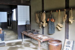
▲Display wears and goods to carry for trip

  The landform of Wada has changed largely since Meiji until Showa period. They reclaimed the ravine of Oikawa river and digged down the ground of Nakasendo to make the road surface flatter. ⇒Explanation
  Since Meiji until now the road administration of Japan has changed the landform to make car traffic efficient.

◆From Oikawabashi to Shimomachi

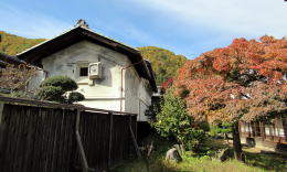
  Walking from Oikawabashi to Shimomachi, you wouls find the ground of Kawachiya which is on the riverside is lower by 0.8 meter than Yamakiya which is 20 meters away from it. The house of Kawachiya is now Historic Road Museum.
  Yamakiya and Kurokiya standing across the rad was a famous wholesale shop of timber. It supplied timber for building in Edo under the order of Shogunate government and clans.
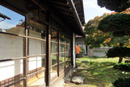

▲Court of Kurokiya

▲View of mud-walled warehouse of Kokuya from Kurokiya's court

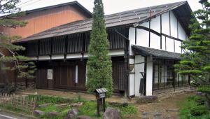
  Kurokiya was a big inn. Until some decades ago its house had been out of service and devatated but was recently restored. Its architectural style looks very graceful. It has a court is still beautiful, thourgh slightly wasted.
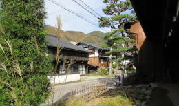
  Would you like to see the town-houses across the road. The nearer one is Shimono-Kokuya whose traditional structures has been kept well.
  The house next to it, putting a garden between them, is Takagi which was once also a big inn.


▲View across the road from Kurokiya's front garden
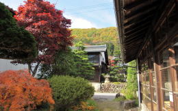
▲On Kurokiya's yard

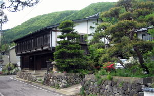
  The structure of the its house looks graceful and grand.
  It is standing on the heigher site-ground by 30-50 centimeters than the road. The height-gap, sustained with stone-wall, shows the depth made by digging down the road-ground.
  A path toward Shinteiji temple runs on south side of Takagi. Then we can lseet the temple and the mountain behind it.

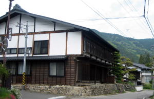
  We would find a large town-house of the traditional structure facing the gate of Honjin across Kaido.
  Considering its site position, I noticed it was holded by the highest rank family of the town. It was the house of the Hatas who was nominated for Wakihonjin and mayor. Now it was Soba-restaurant Tokuda.

  By the way it has been said that the Hatas' ancester came from Chine or Korea in the ancient days. I suppose they were a fraction of Chin clan who refuged from there to Japan. In Japanese one of the letters pronounced Hata is 秦. It was a name of famous dynasty in ancuebt China.
  Some villages with an advanced culture was build to be a key town of Tosando to developed agriculture and weaving-fabric manufacture in the ancient days. I suppose it was because the immgrants from the east asian continant brought with them technologies of agriculture, irrigation construction and fabric manufacture here.

  The main house of Honjin which was rebuilt recently, is the most graceful and grand, to speak about the most notable town-house. Its architectureal style in Edo period was perefctly reproduced.
  I will report about it on the next page. Though it is rebuilt one, it is a very rare and precious case that the main house of Honjin exists thoroughly on such a scale.


House of Kawachiya is Historic Road Museum

View of its front side from Kaido

Height of stone-wall of Yamakiya is remakable.

It is higher by 1.5m than the road.

The house of Kurokiya was used for a inn


Wondeful if such a inn was now !

A mud-walled wrehouse with white plaster is next

Gorgeous view of town-houses standing side by side

View of Dashibari architecture of Simono-Kokuya

View of street

House of Takagi is graceful and grand

Look back at Takagi

View of bellfry gate of Shinteiji from Kaido

Hatano's house with Yakuimon gate was holded by the Hatas as Wakihonjin.

It is now Soba restaurant Tokuda.

Honjin of Wada was rebuilt recently.

【Picture】Museum of Obsidian and Forestry

  This museum display a lot of obsidians to explain its natural history and its using ways by mankind from the Stone Age.
  Beside them it shows the historic materials of forestry.
  Its admission fee is 300 yen, including Honjin and all town-houses around there.

 
Information

Walking Map around Wada

  • Geography around WadaTown
  • Central Area of Wada

Historic Map of Wada

  • Change since Age of Medieaval Castle-town
  • Tracing the town's developmant

Map for Wadatoge Trekking

  • Map for Pass-Walking
  • Information about Historic Sites

Walking around Wada

  • Around Wadajuku Station
  • Neighborhood

Situation near Oikawa in Edo period

  • Vertical Section of Kaido
  • It was so difficult to travel

History of Nakasendo

  • Institution of Kaido and Stge-Towns
  • Shogunate Regime and Kaido System

Architecture of Town -Houses

  • Town-Houses along Nakasendo
  • Learn to enjoy town- walking

木曾路の絵地図

  • 木曾路のすべての宿駅を表示した絵地図です。
  • 木曾路一帯の名所や観光施設の案内に役立ちます。

中山道の絵地図

  • 京と江戸を結ぶ中山道(木曾街道)の絵地図です。
  • 東海道や日光街道、甲州街道、北国街道との連絡を図解。
のんびり写真館

街歩き写真館

木曾路・奈良井の心に残る風景写真を特集

  • 街並み景観、風物
          フォトギャラリー
  • 木曾路・奈良井散策

奈良井まちあるき

小布施まちあるき

別所温泉まちあるき

塩田平をめぐる旅

◆ブログ風の記事案内を見る

|  previous page  |  next page  |