本文へスキップ
Marunouchi, Matsumoto City, Nagano Pref.


■ほかのまちあるきサイト■

Ninomaru section of the park  

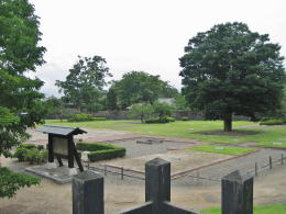
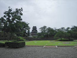
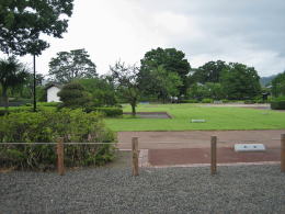
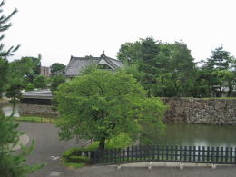
  Matsumoto Ccastle Park is consist of two sections, i.e. the first is Honmaru in which the main tower-complex stands, the second is Ninomaru which encircles Honmaru.
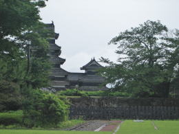
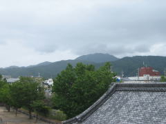
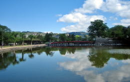
  In the park we can look at Northern Alps Mountains westwards and Utsukushigahara Highlands eastwards. The photo below shows the summit of Jonendake of Alps.

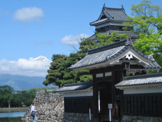
▲Summit behind main tower is Jonengdake of Alps

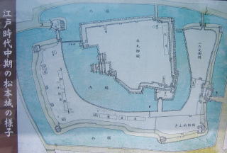
  The picture-map on left side,《松本城の縄張り図》, tells us that for the usual (daily) administration the buildings and facilities of Ninomaru were more important than the main towers of Honmaru.
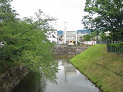
  The map shows us that Ninomaru surrounded Honmaru on three sides, putting the moat between them. And San-no-maru encircled them with Soto-bori, i.e. the outermost moat.
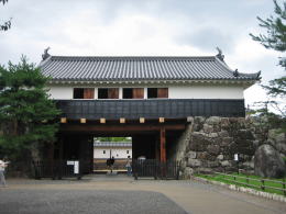
  Honmaru was functioning as a symbol of the clan lord's authority in usual and would take a military role in the emmergency, for example in a war.

■Around Ninomaru■

  Shall we alk around Ninomaru ?
  A northwest part of Ninomaru moat is now a lotus pond. Though in those days it was much a larger water-pool connecting the inner moat with the outer, it has been reclaimed almost parts until now.
  On the westside of it is now a field of Ume trees where several warehouses called Hassenbyo-gura were standing in Edo period.
  As I mentioned before, on the northside of the moats a avenue runs. Walking along it eastwards, I found a wooden bridge, called Ninomaru-ura-Gomon-bashi, over which I entered Ninomaru garden.


Watching mound is at the northeast corner of the second site.

  There is a mound-place like a lookout at the northeast corner of the site. Looking down from it, I found a large lawn field where the Palace of Ninomaru was standing once.
  It had remained until the beginning of Meiji era and had used for a central prefecture hall. But in a time thereafter it was burned out.

  I recommend to look around from Taiko Turret which is standing on the Taiko-mon. Then you would enjoy a wonderful wide view of the city and mountains around it.


View of Honmaru from dram-turret

View northeastward

  The altitude of the skyline of mountains around the city, in the picture above, is about 1000 meters. The summit over them under clouds is Toyagamine (altitude 1629 m).   If it's fine, we would look out the highest summit of Oogato(altitude 2008 m) among Utsukushigahara.


Once a huge pond but now a lotus pool

A view from the side of the inner moat
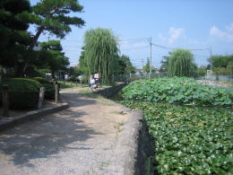
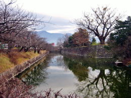
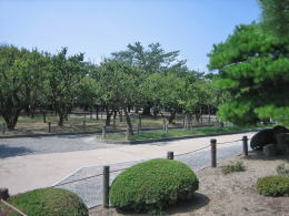
Field of apricots on moatside

a view of the inner moat

There had been Ninomaru-goten palace over there until early Meiji era.


▲Main tower over trace of the palace

View from Taiko-yagura turret

Gate-house called Taikomon

Information

Trip on highlands

Map of cultural assets

  • Map made by commitee fpr cultural assets
  • Usuful for town walking!

Picture of castle-Nawabari

  • defence concept of castle
  • Allocation of moats
  previous page | next page |