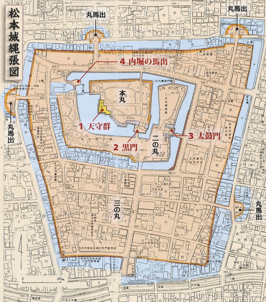
◆Form and Allocation of Moats in Nawabari of Matsumoto Castle◆
from:『ビジュアル・ワイド 日本名城百選』、2008年 小学館、p141
From Nawabari picture, the core zone, Honmaru, was surrounded by tree-fold wide moats, huge water hazards in Edo period. There had been the huge-deep-swamp area formed by Metobagawa river and Daimonzawagawa.
They dug the bottom to make moats to concentrate water into them and accumulated mud to build the bases for tha castle and towns, thus to reclaim land.
Then castle-building was the great scale of business of reforming and reclaiming land with city-making.
As Sobori, the outmost moat, which would be reclaimed in Meiji period, conneted with rivers and cannals, it was a process of the building traffic system.
The shape of Sobori was trapezoid. The northern base line width was 600 - 700 meters and the southern base width was 400 meters. The depth was 700 meters.
The width of moat on the east side of Ootemon was 50 meters. The outer bank-belt zone was called Nawate.
The south end of the moat touched with Metobagawa river and the west end was close to Daimonzawagawa river.
Therefore they reserved water in moats from the headstrems of the rivers. Once they said that Matsumot Castle looked like a castle floating on the lake.
to image the main zone of the castle in Edo period