本文へスキップ
Marunouchi, Matsumoto City, Nagano Pref.
 

■ほかのまちあるきサイト■

 
Concept of Castle and Moats  

  Standing at the center of the city, Matsumoto Castle symbolizes its culture and history, as a significant landmark. Especially water-system of moats hemmed by rich greenbelts takes a core-role forming the landscape of the city core-zone.
  Blown by the wind, the surface of water waves and reflects sunshine.
  Now walking along the moats, I would like to decipher Nawabari of the castlet. It means a grand-design of the castle-defence as a whole, in other word a castle-making concept including its downtown.


Taikomon and Masugata-koguchi rebuilt

Nawabari-picture of Matsumoto Castle

  On the eastside of Ninomaru, Taiko-mon which was rebuilt 1993 is standing. This gate-complex is consist of two gate-houses.
  The outer one facing the moat is Ni-no mon, i.e. the second gate, and the inner one is Ichi-no-mon, i.e. the first gate that is a big turret-gate.
  In those days, the warning drums were set on the second floor of the latter. From the view point of the architecture, the former is the type of Korai-mon, the latter is of Yagura-mon.
  Each gate is gotten between the stone-walled earthworks. If you want to enter Ninomaru, you must turn in a right angle after going through the outer gate and turn again before passing the inner gate.
  Thus you must turn twice on a narrow way surrounded by the gate-houses and stone walls, from which they could shoot crossfire by guns or bows against the enemy. Such a defence-structure is called Masugata-koguchi.

■Walk around Moats■

Decipher Castle-Making Concept

  At first I began to walk around the moats from the northwest entrance of the park to the south entrance, againt the clock-hand rotation.
  Thereafter from the same start-point, walking through Ninomaru Park to Taiko-mon, I got out to Marunouchi Street and went northward along the Ninomaru-Bori moat over Fukashi Bridge to Soto -bori.

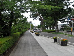
  The avenue between the castle and Ootemon was a part of San-no-maru, i.e. the third site, the outside of which was surounded by a moat named Soto-bori, i.e. the outer moat.
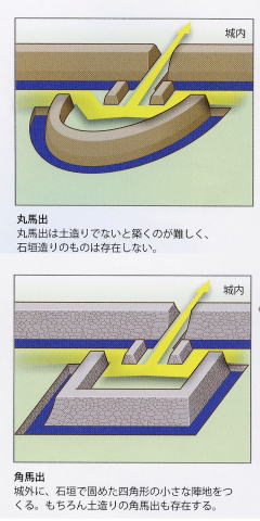
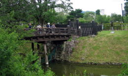
  The road running from east to west between Kaichi 1 Chome and Mastumoto Shrine was a bank line of the moat. At its crossroads was lying Maru-umadashi, i.e. a arc-shaped banker.

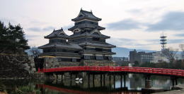
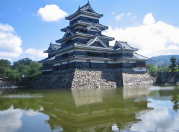
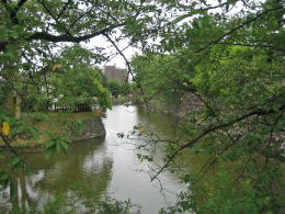
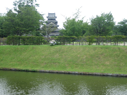
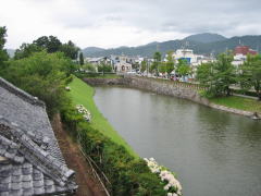
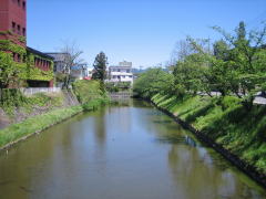
  Now We find a wooden red bridge named Tanuki-bashi, which would reaches Honmaru, over a wide moat. As the moat here is the widest, the main tower-complex looks like a castle floating on the lake.
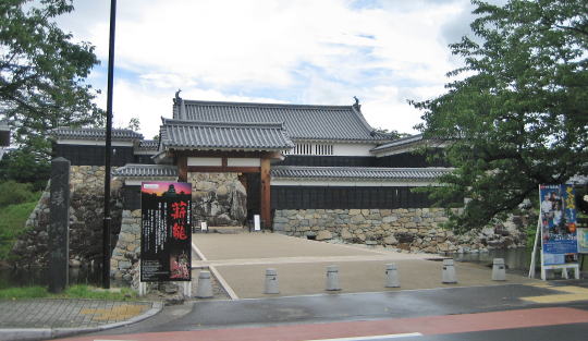
  Walking along the moat, we pass by Kuro-mon, the black gate, and reach the south-entrance of the park. The oblong section (with longer side of 300 meters) from here to north was once a part of the moat named Ninomaru-bori.
  The section has been a residential town but now the city autority plans to restore the moat.


▲Side walk on north side of castle-park

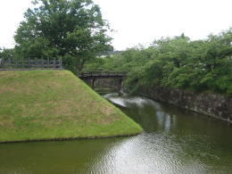
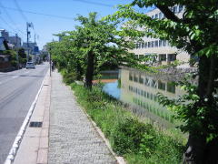
  The part of the prefectural road 67 was San-no-maru, the third site of the castle, in Edo period. Sotobori, the outer moat guarded on the north side of it. Two bridges, at the end of them the bankworks called Umadashi were lying, were crossing over the moat.

Umadshi(mouse on here) from:小学館『ビジュアル・ワイド 日本名城百選』2012年

  Then, let's go back to the starting point and walk along the moats in adverse.
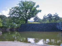
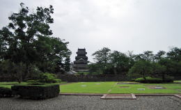
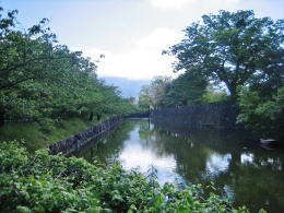
  The earthwork of Honmaru, the core site, are covered thoroughly with stone-walls. But that of Ninomaru, the second site, are half-covered. Only the parts touching water are covered with stone-walls.
  Such a earthwork style is called Hachimaki-doi, i.e. a bankwork of the head-band cover. Hachimaki means a head-band and Doi means a earthwork.
  Comparing the earthworks of the both sites, we notice the rather big difference of their height. Honmaru earthwork is much higher than other sites. That means the difference of their deffencibility and military importance.


▲View of moat from Taiko turret
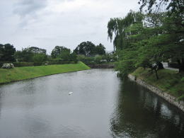

▲View westward


▲View eastward

  Walking over a small bridge, called Ninomaru-ura Gomon-bashi, over the moat, we get into Ninomaru and through it we arrived at Taikomon. There was once a huge palace, called Ninomaru-Goten there. Just after administrative reforms in the first phase of Meiji period it was used for a prefectural hall. But was burned out before long.


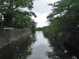
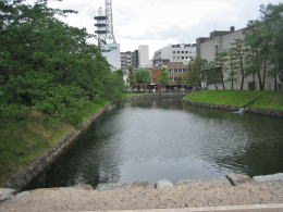
The pool is a vestige of the outer moat.


It is now a shallow pond.

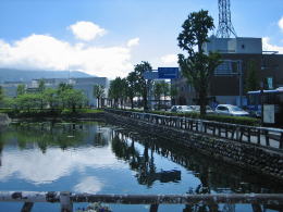
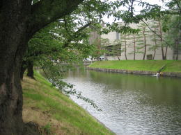
  Going on Marunouchi street east, we get to Fukashibashi bridge. The pools beneath it is the vestiges of the outer moat, called Sobori.


Street between Castle and shrine

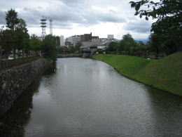
View of moat from northeast gate

Stone-wall of Honmaru at northeast-end

Tanukibashi bridge in vermilion

View from side of widest moat
Main tower looks like floating on it
Grandest view

West entrance of castle-park
On right hand is Daimyocho street.
It was San-no-maru, the third site.
Utsukushigahara highlands far away above moat

the Northern part of the inner moat : On the right hand was San-no-maru once. It encircled Honmaru and Ninomaru.

Over the stone-wall is Hachimaki-doi

Moat between Honmaru and Ninomaru
Honmaru's stone-wall is much higher than another

Small bridge called Ninomaru-ura-gomon bashi over moat

Ninomaru park

Right side of moat was Ninomaru and left side was San-no-maru.
From Meiji period and thereafter the grand level of ex-San-no-amru area was being raised to build city offices.

San-no-maru continued from left side bank to buildings across the moat. It encircled the inner sites of the castle.

The northeast corner of Ninomaru is most beautiful among bankworks.


View of the castle over the outer moat from front of the city hall

Information

Trip on highlands

Map of cultural assets

  • Map made by commitee fpr cultural assets
  • Usuful for town walking!

Picture of castle-Nawabari

  • defence concept of castle
  • Allocation of moats
  previous page | next page |