|
������́A��Ȑ�Ƃ��̎x���̐Z�H�łł����c�ؒn�`�𗘗p���č\�z����܂����B
Article in English
���c�ؒn�`��
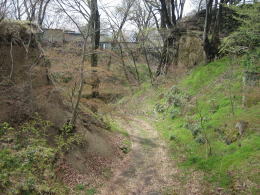
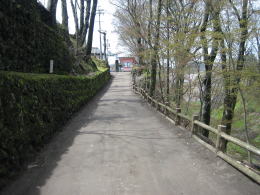
������́A�X�������̏鉺�������Ⴂ�ꏊ�ɒz����܂����B����́A��Ȑ삪����o�����L��Ȍk�J�̉��Ɉʒu���Ă��܂��B
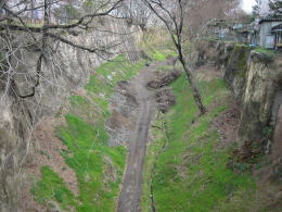
��ԘA��R�[�ɍL���鍂���u�˂̎Ζʂ𗬂ꉺ���͐�Ȑ�ɗ��ꍞ�݂܂��B�����̉͐�́A�ΎR�D�̑͐ςłł�����n��N�H���ēc�ؒn�`������o���܂����B
�L��Ȍk�J�ɂ́A���͂��R�ň͂܂ꂽ���̂悤�ȑ�n���������`�����ꂽ�̂ł��B
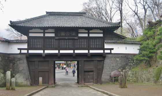
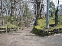
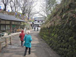
������́A���̓c�ؒn�`�����̂܂ܗ��p���Ēz�邳��܂����B
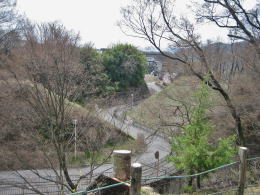
��������������É������ɒʂ��铹�H
�����j�̍r�g�����Ԃ遟
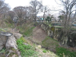
���̂��߁A��s�̊e�ȗւ͍��፷�̑傫�ȊR�Ɏ��͂܂�Ă��āA�܂��Ɏ��R�̗v�Q�ɂ���Ėh�����ꂽ��ƂȂ��Ă��܂��B
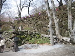
�Ƃ��낪�A�����ȍ~�̏����̓��H������s�s�J���A�S�����݂ɂ���āA�O�̊ۂ������A�������_�{�̕ӂ�̐Ηۂ�Ί_�͂��������̂���A����͐������Ă��܂��܂����B���o���ꂽ�́A�H�Ղ�H���̐����Ɏg��ꂽ�悤�ł��B
��̊ۂ���ԏ��A�k�̊ۂ̐Ί_����̂���Ă��܂��܂����B�����̓�̊ۂ̐Ί_��1984�N�ɕ������ꂽ���̂ŁA�]�ˎ���̐Ί_�Ƃ͂��Ȃ����Ă���悤�ł��B�k�J���̐Ί_�E�Ηۂ͕�������Ă��܂���B
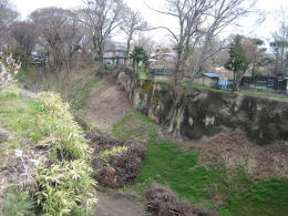
����̊ۉ��̋����X�߂��̐Ί_
Article in English
�Â��G�n�}���Q�l�ɂ��č]�ˊ��܂ł̒n�`��z�����Ă݂܂��傤�B
��̋ȗւ��\�����鍂��́A�@��W��Ղ̏��ƘV���~�A�A�O�V�ہA�B�̂̎����_�ЂƎ����~������ȗցA�C��V�ۂƓ�ہE�k�ۂ̋ȗցA�D�{�ہA�E�đ��Ȃǂ̑��Q�̍���Ȃǂł����A�����͂��ׂċ����ɂ���Č���Ă��܂����B
��Ō��ꂽ�ʘH�ɂ֖͊��݂��Ĕԕ���z���ėv�Q�Ƃ��Ă��܂����B
��m�ۂ�A��ہA�{�ۂ���ㅂ���Ί_�E�Ηۂ̏�ɂ́A��Ԃ�S�C���Ԃ������ꂽ�������y�����݂����Ă��āA�O��������̌������Օ��E�h�삵�Ă��܂����B
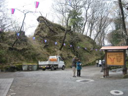
����̊ۂ̐Ί_�͒i�u�R��
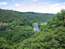
������G�c�Ɍ`�e����ƁA�������͐�̐�����ӎO�p�`�ŁA��ӑ����Ȑ삪���A�����ʂ�藧�����ג�������ƊR���i�삷��`��ɂȂ��Ă��܂��B
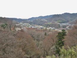
�����āA���̖k�E���E��̎O���̎��͂Ɖ��~�̊X���݂���芪���Ă��܂��B����ɂ��̊O���ɁA�^�ǂ���r���A�{���A�����A�s���A�����܂ł�����k���X�������̒����̉ƕ��݂����͂�ł��܂��B
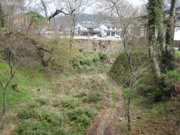
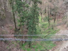
�������芪���i�u�̉��𗬂���Ȑ�
|