本文へスキップ
Ootsumago, Kisomachi town, Nagano Pref.
 
  The townscape seen from the brook -side of Otarugawa near Maruya, Oomiya and Tsutamuraya.
  The houses are sticking together on the steep ravine -slope. Their sites are sustained with stone -walls like terraced fields. The ravine has been carved by the brook.

 
A Hamlet of Old Houses

  The word Tsumago, in Japanese, originally means the bottom of a basket. It changed into the deep end of a ravine. The word Oo means the greatness or the extreme. Then Ootsumago means the deepest end of a ravine. Ootsumago is a small village lying at deep end of Araragi ravine, which has been made by a branch of Kisogawa River.
  Ootsumago is a area behind Tsumago town, where we would look down a deep ravine-bottom of Magome-Toge pass.⇒Walking Map along Magome-Toge


▲The stone-walls overlapping, making stairs, like a castle and the rooves either, along Nakasendo

▲A spot where the inns ―― Omiya, Maruya and Tsutamuraya―― standing side by side

▲The rooves of inns, which has cahnged from beeing covered with wooden-bords into with tiles

  In Ootsumago, the villages consists of the houses built on stone-walled terraces sticking on steep ravine-side. The houses are overlapping toward the sky.

■Inns of old houses■


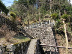
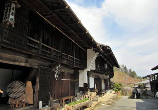
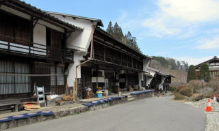
▲Stoe-walls overlapping like a castle

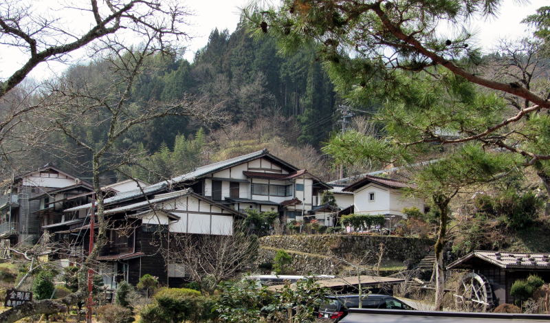
  In this turn I will start from the sign-bord of Ootumago, over the Otarugawa, and walk up along the steep path, the old Nakaendo, southward.
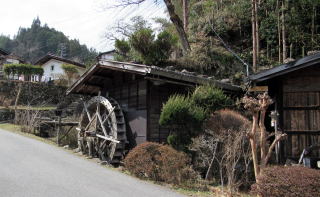
  Around the way we would find the stone-walls overlapping and a tiny mill-house, feeling, at home, a taste of Kisoji.
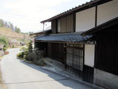
  There are the old inns, Maruya, Tsutamuraya and Omiya, standing side by side on a hill-terrace.


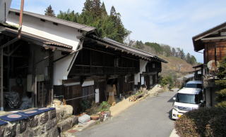
▲Not a few old houses notable

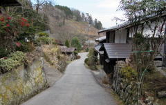
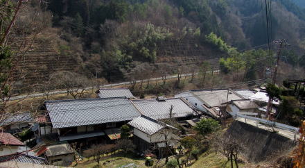
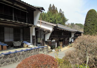
▲Looking back at the slope way

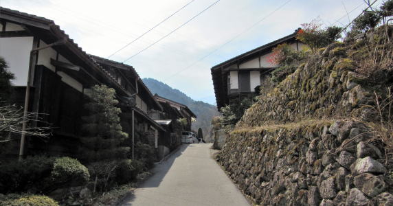
  Maruya and Tsutamuraya has the particular walls called Sode-Udatsu, old Japanese house decoration, on both front -side just under the rooves.
  The scene has kept the old shape of Nakasendo-Kisoji. However I found just only one inn, Maruya, keeping operation that day. Was it off-season ?
  Once there were not a few people managing stay houses in Ootsumago but nowadyas because of aging they cannot keep operation the hospitality -business.


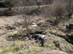
▲Look down at Otarugawa
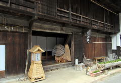
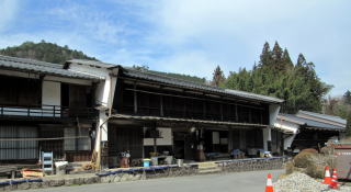
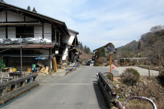
▲In front of Maruya

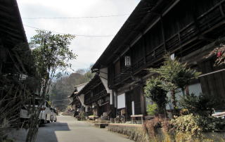
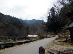
  Walking on along Nakasendo, we would meet pref. road 7, accross which we would get into the paved path to Magome. Then let's imagine the old days.
  In old days travellers from there came into Ostsumago town, turning left at Koshinzuka, which was the religious stone -monument made by people to pray for the peaceful life..


▲The old Nakasendo to Magome-Toge

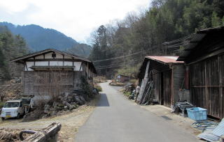
  Walking on the way and passing the bridge over Ortarugawa, the old-days travellers must have found the inns.
  After passing by the inns, they walked down the path and arrived at the area near Kongoya. Thereafter turning left over the samll bridge and walking up the slope path, they got into Shinmei village.
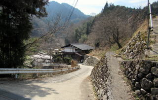
  The paved way running throung it is the old Nakasendo. The way is running around the ridge and downward to Araragigawa. Walking over the bridge over it, we would get to the entrance to Tsumago town.


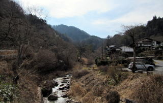
Otarugawa ruuning on the ravine-bottom

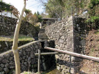
Stone-walls fixing the steep slope

A tiny mill-house

The old inns standing side by side on the hill

Old town-houses of Dashibari-style

Udatsu wall of Kisoji-style

Zabuton mattresses dried by sunshine and wind

A row of three inns are beautiful

The old houses calling nostalgy

In old days travellers got into over the bridge

You would find Koshinzuka standing over there

The steep path to the village upward
 
中山道を学び体験しよう

妻籠宿街歩き絵地図

  • 妻籠宿全体の絵地図です。
  • 街歩きに役立ちます。

馬籠峠を歩く

  • 馬籠宿から妻籠宿まで馬籠峠を越える道を歩きます。
  • あなたも歩いてみませんか。

和田宿街歩き絵地図

  • 和田宿の中心部を詳しく案内。
  • 宿駅の前後の街歩きも案内。

和田宿の歴史絵地図

  • 中世城下町の時代からの変遷を説明。
  • 宿駅の発展の痕跡を訪ねる。

和田峠トレッキング案内絵地図

  • 和田峠めぐりするための絵地図。
  • 峠の史跡や名所をガイド。

和田宿近隣散策

  • 和田駅ステーションから
  • 和田宿温泉ふれあいの湯まで

江戸時代の追川付近の街道

  • 路面地形の断面図で解説。
  • こんなにも街道交通は大変だった。

中山道の歴史

  • 中山道に即して街道制度の歴史を説明。
  • 幕藩体制と街道・宿駅との関係を考える。

中山道の町家造りの説明

  • 中山道宿場の町家造りの仕組みの解説です。
  • 街並み探索がもっと楽しくなります。

木曾路の絵地図

  • 木曾路のすべての宿駅を表示した絵地図です。
  • 木曾路一帯の名所や観光施設の案内に役立ちます。

中山道の絵地図

  • 京と江戸を結ぶ中山道(木曾街道)の絵地図です。
  • 東海道や日光街道、甲州街道、北国街道との連絡を図解。
のんびり写真館

街歩き写真館

木曾路・奈良井の心に残る風景写真を特集

  • 街並み景観、風物
          フォトギャラリー
  • 木曾路・奈良井散策

奈良井まちあるき

小布施まちあるき

別所温泉まちあるき

塩田平をめぐる旅

◆ブログ風の記事案内を見る

|  previous page  |  next page  |