本文へスキップ
長野県松本市開智
 

■ほかのまちあるきサイト■

 
歴史の厚みを感じる街  

Article in English Harmony of History and Nature

I would like to walk in Kaichi town continuously.
The large hill is creeping just behind the town. Walking from there northwards for a while, we would arrive in Joyama, Arigasaki, or Asama-onsen on the hillside rising gently.
The picture below shows the elementary school-yard, where school boys play basebal and Kaichi School.

As the town is a residential area, there are very a few tall buildings. Then we can look around the mountains or highlands over the town.

  引き続いて、開智地区をめぐり歩きます。
  開智学校の背景には丘陵が迫っています。開智から北に歩けば、ほどなく城山、蟻ケ崎、浅間温泉などの起伏のなだらかな山地にいたります。

▲開智学校 手前の小学校の校庭では子どもたちが野球の練習

  このあたりは、主として住宅街で、高い建物はあまりありません。道路や広場、駐車場などに立てば、周囲の山並みや高原を眺めることができます。

■歴史が薫る岳都■

Article in English Circumstance of the Town

The urban area of Matsumoto is encircled by Alps Mountains on the westside, Utsukushi-gahara Highlands on the eastside, Chikuhoku-mountains on the northside and Enrei Highlands on the southside. Standing on some open places, we can look at the mountains or the highlands over the townscape.

Putting back our eyesight to the ground, on the near side of the quasi-european house is standing the city-founded library. Its building, whose walls is thoroughly covered with shining glass, is of the super-modern style. The library is surrounded by the greenbelts. They had better to take a walk outside, if getting tired to read books.

A wooden house, of european style, neighboring on the westside of Kaichi School is the priest house which was built also in Meiji period.
A long greenbelts are lying on the westside of them. The narrow mountain-stream named Omazawa-gawa is surrounded by trees. The ravine made by the stream is narrow but deep. Such a landform shows us clearly its invasion-effect it used to have.
However, now surrounded by the bank-protection works, it runs quietly through the residential town.
For Kaichi is a town gotten between Oamzawa-gawa and Metoba-gawa, it has a great deal of water vein under the ground. There are not a few well-springs there. In Old Baba-cho there is the site of the well named Yanagni-no-Ido.

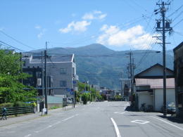
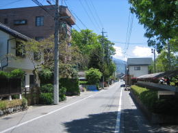
  松本の西方には北アルプス、東方には美ケ原高原、南方には塩嶺高原などが控えている。道路や駐車場など、少し開けた場所に立つと、これらの山並みを見ることができる。


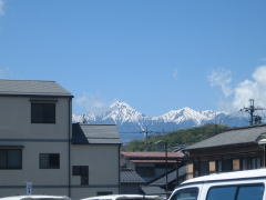
▲住宅地の家並み越しに見える北アルプスの常念岳と横通岳
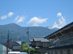

▲街の東方にそびえる袴越山
その奥には美ケ原高原

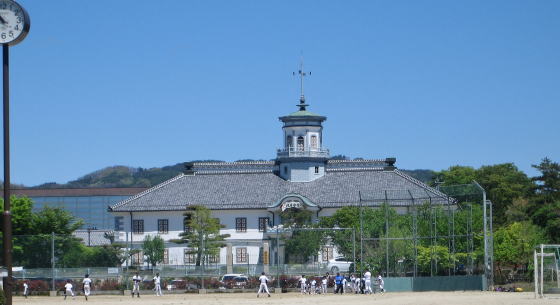
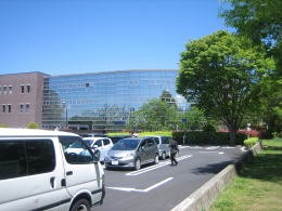
  街並みに目を戻すと、明治時代の疑似洋風建築のすぐ横には、ガラス張りの超モダンな市立中央図書館が並んでいる。図書館の周辺には緑が豊かで、読書に疲れたら散策するのもいい。
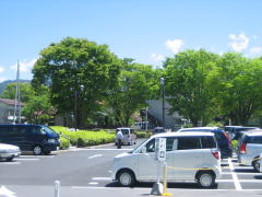
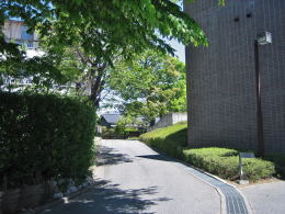

▲図書館の駐車場脇の樹林

▼樹林の下は大間沢川の小渓谷

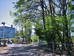
  司祭館と中央図書館のすぐ西側には樹林帯があるが、それは大間沢川の渓谷を取り巻く段丘の縁をなしている。渓谷は深く、その昔、豪雨のあとで大間沢川が見せつけた浸食作用の名残りだ。
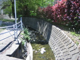
  今ではこの川は、都市化にともなう治水・護岸工事によって住宅街を静かに流れる小さな沢になっている。

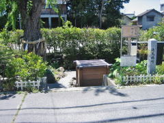
  開智地区は大間沢川と女鳥羽川に挟まれた台地なので、地下には豊かな水脈(帯水層)があるらしい。旧馬場町には柳の井戸の跡がある【写真下】。


街の東方には美ケ原高原が迫る

開智学校の脇にあるヤマナラシ(ポプラ)の老樹

開智学校の隣にある司祭館。これまたアーリーアメリカン様式で、開拓時代の素朴なイメージだ。

松本市中央図書館
反射ガラスの壁面が周囲の風景と青空をを映す

図書館の西脇を抜ける小路。
その先は閑静な住宅街。

樹木が多い開智の住宅街

住宅街を流れる大間沢川の支流

松本めぐり歩き

松本城周辺の絵地図

  • お城の近隣の文化財を案内
  • 街あるきに役立つ

市街まちあるき絵地図

  • 取材制作中。

松本城の縄張り絵図

  • 江戸時代の縄張りを図示
  • 堀の配置がよくわかる
のんびり写真館

街歩き写真館

木曾路・奈良井の心に残る風景写真を特集

  • 街並み景観、風物
          フォトギャラリー
  • 木曾路・奈良井散策

  小布施まちあるき

  別所温泉まちあるき

  塩田平をめぐる旅

  木曾路をめぐる旅

  信濃の仏塔めぐり

  前のページに戻る | 次の記事に進む |