|
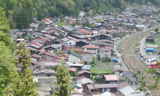
After passing the ridge-line, when the travellers come in front of Shizume Shrine, they would get the perspective of the rows of houses along the street on the side of the stone-lantern.
The town is divided into three parts, i.e. the Upper Town, the Middle Town and the Lower Town in order which is nearer Kyo.
【⇒A Picture-Map of Narai Town】
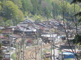
The rows of houses are caught between the ridge-line northwestward and the JR railway southeastward.The town is formed in the thin-long shape.
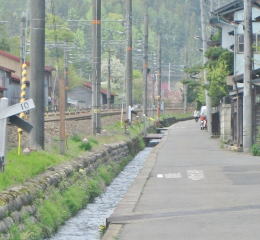
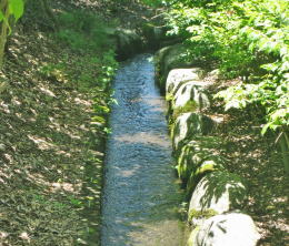
Many waters which spring out on the slope of mountain northwestward gather and meke some brooks and flow across the street into Naraigawa river.
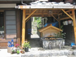
There are some waters springing out along the street, then some water-places are utilized for drinking. The town has quite a much water-resource.
In such a way, the flowing waters are consisting important elements of the landscapes of the town.
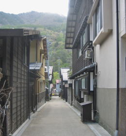
We find many ways or paths running across the street. Some ways have width over 2 meters and some have so narrow one that people can not pass against each other.
Some ones start from the way alongside of the railroad and run across the main street, reaching the foot of the mountain. Some are passing by the houses and vanishing in front of the hill.
Wider ways reach the temples or the shrines on the foot of the mountain, then they turn or vanish.
Main temples or shrines stand on the foot of the mountain or on the hill-bank.
Since the old days the temples and the shrines has been the ground of the religion and the refuge-area where people meet together in the case of disasters for example flood. Therefore the location is reasonable.
|
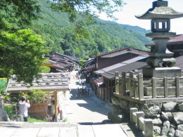
The street-view from the side of stone-lanterns of the shrine
|