|
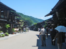
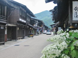
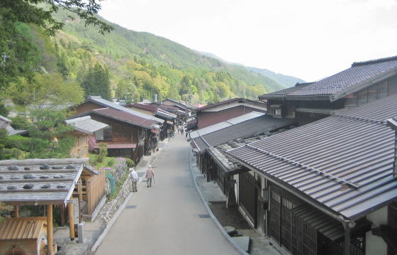
Walking along the street, watch the configuration of Narai town, which is filled with the traditional and calm beauties, surrounded by mountains, as a whole. Let's look at the town on the riverside, in the context of the natural and historical environment.
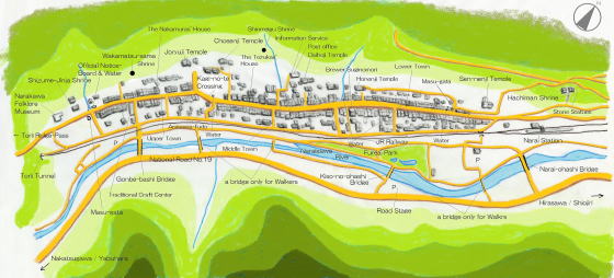
▲A Picture-Map of Narai Town with instructions
Narai-juku stands in 5 miles from Yabuhara-juku, also from Niekawa-juku. In the old daysNarai was the terminal stage town, entrepôt. Then it was a key town where travellers from Niekawa or Shiojiri would get ready for walking over the difficult ridge.
|
◆The East End of the Town◆
|
|
Leaving Shiojiri and going up along Nakasendo, then passing by Niekawa and Hirasawa, we will arrive at Narai town. It is around 25 miles journey along the old Kaido-road.
The road is running through the bottom-line of the ravine. The travellers in the old days kept walking on the path surrounded by thick forest on the foot of mountains before reaching Narai town.
It is said that there were the row of Japanese ceder-trees, which had been cared by people since older days, on both path-sides. The travellers must have walked along the narrow way, as though stepping on the roots of trees.
On the moutain-path people might pass against each other, rubbing their sleaves against each other.
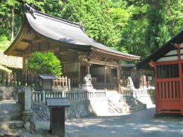
Before entering Narai's town-street, at the east end of the town we find the old Shrine of Hachiman on the slope half way down the mountain reaching in front of the Narai station.
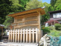
The shrine has the stone steps from the road. Turning east half way of the steps, we find the 200 stone Jizo-statues.
Near the statues stands old ceder trees under which a narrow path is running up the slope and vanishing into the grass. The path is the ruin of the old Nakasendo, i.e. Kisoji of the old days.
The row of the ceders remains the feature what the road used to be. It was the entrance of the Stage-Town.
The travellers who got out of the deep forest would feel easy when they found the town-street ― under their eyes ―standing in the open perspective.
Now we stand at the entrance of Nrai town, then we are going to walk along the street southwestward.
|
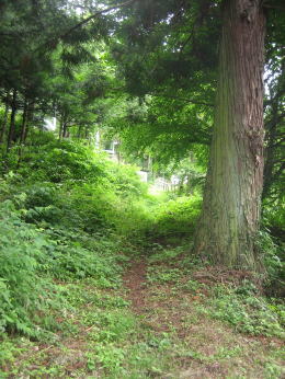
The mountain-path of Kisoji in the old days has already been vanishing into the bush and the grass.
|
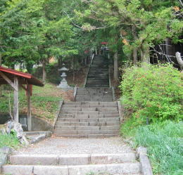
Climbing up to the top of the stone steps, we will arrive at the shrine of Hachiman-gu. |
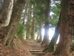
Turning right (east) half way of the steps, we find a narrow way surrounded by old trees (look at the picture above ). It is the remain of old Kisoji. The travellers walked along the path under the trees. |
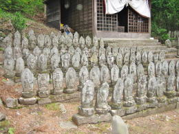
The 200 Jizo-statues behind the shrine
|
 |
|
- A picture-map of whole Nakasendo from Edo to Kyo.
- Shinano country and other main roads connected with Nakasendo.
- A simple map of Kisoji's geography
- Ways, rivers and stage towns
- A picture-map of the rows of the town-houses
- A guidance for sight-seeing of townscapes
- Explanation about the design of the town-house in Narai
- From the architecture of houses, learn the lif-style of the people.
|
|
|