本文へスキップ
Magome, Nakatsugawa City, Gifu Prefecture 


Walking on the Pass

  To enjoy taravelling in Kisoji, let's walk along the pass way running over Magome-toge. It takes 2 hourrs and half to walk trough there. The pass is the very adequate course for hiking or trecking.
  The distance of the way is about 8 Kilometers from Jimba of Magome to Omata of Tsumago. Walking course is slightly shorter than driving course of the pref. road. There are some places where they walk through on the stone-pavement and on the brige-way.
  The reason why the walking course is shorter than driving course is that the driving way must be running around the ridges and undulations, through which they can walk straight safely, of mountains for safetiness.
⇒A Picture-Map of Magome-toge pass 峠の集落のはずれ
【The picture above】 At the end of the village on the pass. Walking along the way ahead, We reach the ridge of the pass.

⇒A Picture-Map of Kisoji

◆Walk Slowly on the Pass-way◆

  The stone-pavement is over at Jimba, the crossing point with pref. road. But the away upwards continues ahead.
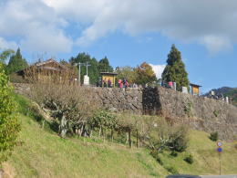
  Over the Official Notice-Board is the lookout-bank sustained by high stone-walls. From there we look over at Mt. Ena or the landscape far away Magome.
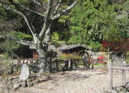
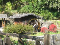
  In five minutes walk from the lookout, we meet pref. road again on the way downwards. We find a water-mill house there in a park by a brook.

【The photo beneath】 A water-mill house by a brook

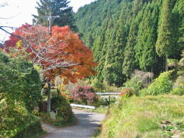
  The pass-way, a narrrow path through the deep forest in mountains, just has started. On the undulated way, we find no danger.
  The old Kaido path, running across the pref. road and lying over on often, gets again into the mountain forest. There are some places adequate for the rest anywhere.

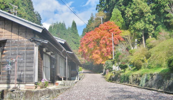
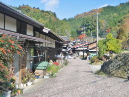
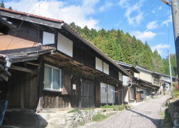
◆Houses of Village on Pass◆

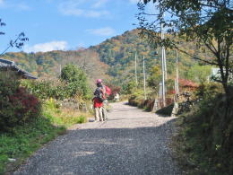
  The way near the village on the pass is paved nicely. People coming by car had better walk there, getting off car, to meet wonderful views.

  Especially in the village on the ridge-pass, we find the houses of traditional-architecture making up a fine landscape. There are a lot of nice tourist-scenes.

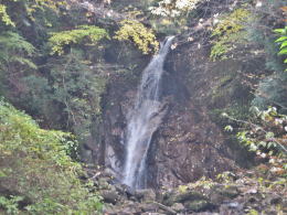
◆Mountain-Path and Falls◆

  There are no difficult places danger for walkers, but in some narow points which need taking care enough. However there we can watch very wondeful landscapes.
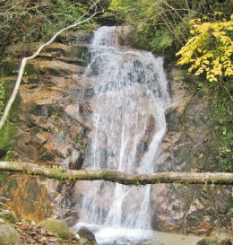
  After passing by the midway of the passs-way, the way goes through a deep valley, where we find a couple of falls, Odaki, i.e. a male-fall, and Medaki, i.e. a female-fall.
  Around there we walk along the brook on the bottom of the valley. The path reminds us a bridge-path of Kiso-no-Sando.【The picture beneath】

桟道

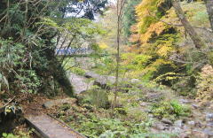
  Reaching there, it is about 2 Kilometers to Tsumago. In time we get into a winding path of stone-pavement in a forest.
  If you have enough time and physical enargy then, you would have a nice experience if you visit O-tsumago village following the guide-board. You will find houses of the old Machiya architecure.

陣場の展望台

A lookout bank

沢の畔にある水車小屋

We find a water-mill house just after getting out Magome.

旧街道

The old Kaido way often crossing pref. road

峠歩きを楽しむ人たち

Many people try trecking over the pass.

峠の集落

In the village on the pass-ridge are some houses reserving the old-design.

集落の家の造り

Houses of Machiya design

女滝

Medaki, a famous scene of Magome-toge

男滝

Odaki, the bigger and more powrful
 
learn and experience

A picture-map of Magome

  • Picture about the town as awhole
  • Guiding Town-walking

A picture-map of Tsumago

  • Picture about the town as a whole
  • Guiding Town-walking

A simple map of Kisoji

  • A picture-map the ways touring aound 11 stage-towns of Kisoji
  • Guiding the tour around Kisoji

A Chart of Nakasendo

  • A picture-map of whole Nakasendo from Edo to Kyo.
  • Shinano country and other main roads connected with Nakasendo.
  • The picture-map shows main Kaido assigned by Shogunate government.

A chart about stage-towns of Nakasendo

  • A chart showing all the stage-towns of Nakasendo

A tour-map about Kisoji

  • A picture-map explaining the tour-course arond Kiso area
  • Guiding the tour-spots and place of the stage-towns

A Picture-Map about Main Rivers

  • Show the Water-Systems of Shinanogawa and Kisogawa.
  • Main Rivers in Nagano Pref. and neigboring areas.

奈良井まちあるき

小布施まちあるき

別所温泉まちあるき

塩田平をめぐる旅

previous page |